Explore the Detailed Asia Continental Map for 2026 Insights
7/18/2026
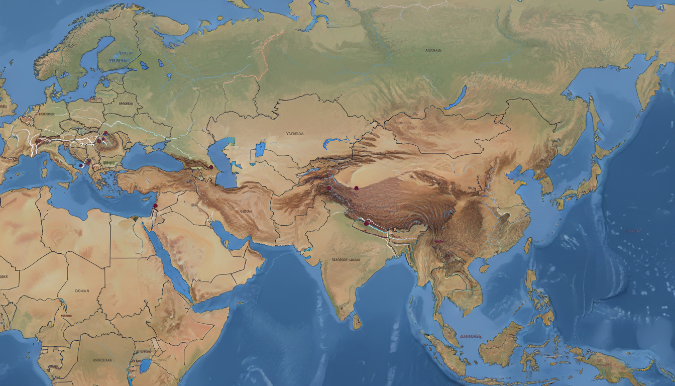
In short, what you'll discover in this article: Explore the essentials of an asia continental map, including political, physical, and thematic types. Learn how map projections affect your view of Asia, discover interactive features for detailed exploration, and find practical uses for students, travelers, and researchers.
1. Introduction — What Is an Asia Continental Map and Why Is It Useful?
An asia continental map is a comprehensive visual representation of the entire Asian continent. It helps users understand the geography, political boundaries, physical features, and various thematic aspects of Asia.
Whether you’re planning a trip, preparing a presentation, or simply expanding your knowledge, a clear and detailed map of Asia is invaluable.
Such maps provide insights into the continent’s vast diversity—from countries and capitals to mountain ranges and rivers—making it easier to grasp Asia’s complexity at a glance. A well-designed asia continental map can also support educational purposes by offering accurate geographic context.
2. Types of Maps of Asia
2.1 Political Map (Countries and Borders)
The political map of Asia highlights the continent’s 47 countries with clearly marked borders. It shows capitals and major cities, helping users identify political divisions and administrative regions.
This type of map is essential for understanding geopolitical relationships and planning travel routes across countries.
2.2 Physical Map (Relief, Mountains, Plains)
A physical map focuses on Asia’s natural landscape features such as mountain ranges like the Himalayas, vast plains, deserts, rivers, and lakes. This map type helps visualize elevation changes and terrain diversity, which is crucial for environmental studies or outdoor activities planning.
2.3 Thematic Maps (Population, Economic, Climatic)
Thematic maps provide specialized information about Asia’s demographic distribution, economic zones, or climate patterns. These maps are useful for researchers analyzing population density trends or economic development across regions like East Asia or Southeast Asia.
3. Map Projections and Their Effects
3.1 Common Projections (Mercator, Robinson, Winkel Tripel)
Different projections shape how Asia appears on a map:
- Mercator projection preserves angles but distorts size near the poles.
- Robinson projection balances size and shape for a more visually pleasing view.
- Winkel Tripel projection minimizes distortion in area and distance.
Each projection affects how countries and features look on an asia continental map.
3.2 How Projection Choice Influences Reading Asia
Choosing a projection influences your perception of Asia’s size and shape. For example, Mercator exaggerates northern regions like Siberia while Robinson offers a more realistic continental outline.
Understanding these effects helps interpret maps accurately for education or travel planning.
4. Useful Features for an Interactive Continental Map
4.1 Zoom and Levels of Detail
Interactive maps allow zooming to reveal detailed city names or physical features such as mountain peaks or river courses. This flexibility supports both broad overviews and close-up study.
4.2 Layers to Activate (Borders, Roads, Socio-Economic Data)
Users can toggle layers showing political borders, major highways, or socio-economic indicators like population density or GDP per region—enhancing the map’s informational depth.
4.3 Analysis Tools (Distance Measurement, Filters, Place Search)
Tools such as distance measurement between cities or filtering by region improve usability for travelers or researchers needing precise geographic data.
5. Practical Use Cases
5.1 For Students and Educators
An asia continental map for educational use aids geography lessons by clearly illustrating countries’ locations and physical features like the Himalayas on the Asia map. It supports interactive learning with labeled capitals and major rivers.
5.2 For Travelers and Tourism Professionals
Travelers benefit from maps showing key cities and transport routes across Asia’s diverse regions. Tourism professionals use these maps to plan itineraries highlighting cultural hubs in East Asia or Southeast Asia with detailed East Asia maps.
5.3 For Geopolitical and Economic Research
Researchers rely on political maps to analyze border disputes or economic zones within Asia’s complex landscape. Thematic maps help visualize population growth trends or resource distribution critical to policy-making.
6. Formats and Downloadable Resources
6.1 Printable Versions (PDF, SVG)
Printable asia continental maps come in formats like PDF or SVG for high-quality posters or handouts suitable for classrooms or presentations.
6.2 GIS Files (Shapefile, GeoJSON) and APIs
For advanced users needing spatial analysis, GIS files enable integration with mapping software to customize data layers or create interactive web maps.
7. SEO Tips and Web Optimization for Maps
7.1 Targeted Title Tags and Meta Descriptions
Optimizing titles like “Detailed Asia Continental Map with Countries & Capitals” improves search visibility for users seeking specific geographic information about Asia.
7.2 Alt Text and Descriptions for Images/Layers
Descriptive alt text ensures accessibility by explaining map content such as “Political boundaries of Asian countries with capital cities labeled.”
7.3 Performance (Lazy-Loading Tiles, Image Compression)
Efficient loading techniques like lazy-loading tiles enhance user experience on interactive maps by reducing initial load times without sacrificing detail.
8. Conclusion and Calls to Action
A well-crafted asia continental map is an essential tool for anyone interested in understanding this vast continent’s geography clearly—whether for education, travel planning, or research purposes. To explore detailed maps tailored to your needs or to test interactive tools featuring zoomable layers and socio-economic data overlays, visit singaporesim.com/blog/asia-continent-map.
For travelers heading to Singapore after exploring Asia’s geography, consider comparing eSIM data plans from top providers like eSIM.dog or Yatelo through MyBestSim to stay connected effortlessly during your journey.
This article references a comprehensive political map of Asia available at geology.com, which includes countries with capitals and major cities clearly marked for enhanced understanding of the continent's layout.
FAQ
What are the main types of Asia continental maps?
Asia continental maps include political maps showing countries and borders, physical maps highlighting natural features like mountains and rivers, and thematic maps that display data such as population or climate patterns.
How do map projections affect the view of Asia?
Map projections like Mercator, Robinson, and Winkel Tripel change how Asia’s size and shape appear. For example, Mercator distorts northern areas, while Robinson offers a more balanced and realistic view.
What interactive features enhance Asia continental maps?
Interactive maps offer zooming for detailed views, toggleable layers for borders or economic data, and tools like distance measurement and place search to improve usability for travelers and researchers.
Who benefits most from using an Asia continental map?
Students and educators use these maps for geography lessons, travelers rely on them for planning routes, and researchers analyze political or economic data to understand regional trends.
What formats are available for downloadable Asia maps?
Asia continental maps can be downloaded as printable PDFs or SVGs for presentations, and GIS files like Shapefiles or GeoJSON for advanced spatial analysis and custom mapping projects.

Liam Chen
Liam is a travel and technology writer based in Southeast Asia who has tested eSIMs across the region. At Singapore eSIM he compares travel data plans on Singtel, StarHub and M1 and helps visitors stay online affordably from Changi to Sentosa.