Explore the Full Map of Asia for Travel and Learning in 2026
7/28/2026
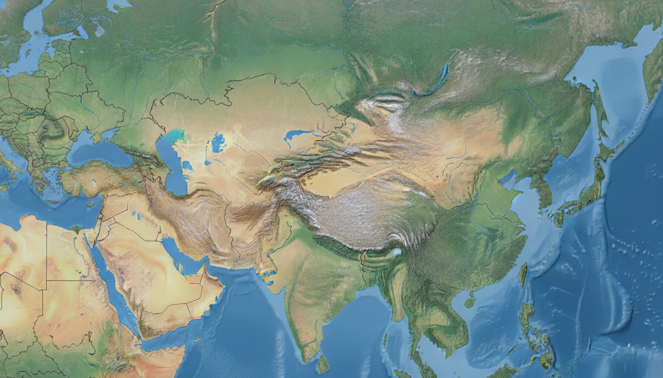
In short, what you'll discover in this article: A comprehensive guide to the full map of Asia, including interactive and downloadable versions, detailed regional breakdowns, thematic maps, and advanced tools for travelers and educators. Perfect for planning your trip or deepening your geographic knowledge.
1. Introduction — What Is a "Full Map of Asia" and Who Is It For?
A full map of Asia is a detailed representation of the entire Asian continent, showing countries, borders, capitals, major cities, physical features like mountains and rivers, and sometimes thematic data such as population or climate. This map serves travelers planning routes, educators teaching geography, researchers analyzing regions, and curious minds eager to understand Asia’s vast diversity.
Available in various formats—interactive online maps, high-resolution printable PDFs, SVG vectors for customization, and GeoJSON/KMZ files for developers—these maps cater to different needs. Whether you want to zoom in on Southeast Asia’s archipelagos or print a large political map for your wall, there’s a suitable option.
2. Main Map of Asia
2.1 Interactive Map Embedded (Key Features: Zoom, Layers, Legend)
An interactive map of Asia allows users to explore the continent dynamically. Key features include:
- Zooming to view countries or cities in detail.
- Layer toggling between political boundaries, physical geography, and thematic data.
- Legends explaining colors and symbols for easy understanding.
- Search functions to locate capitals or landmarks quickly.
This tool is ideal for travelers who want to visualize their itinerary or educators who need an engaging teaching aid. For example, you can explore East Asia’s countries individually or see how mountain ranges stretch across Central Asia.
2.2 Downloadable Versions (Direct Links: SVG, PDF A0, PNG, KMZ/GeoJSON) with Sizes and Recommended Uses
For offline use or printing, downloadable maps come in several formats:
- SVG: Scalable vector graphics perfect for customization without losing quality.
- PDF A0: Large-format printable maps ideal for posters or detailed study.
- PNG: High-resolution images suitable for presentations or quick reference.
- KMZ/GeoJSON: Geographic data files compatible with GIS software and web mapping tools like Leaflet or Google Maps.
Each format suits different purposes—from creating personalized travel guides to integrating maps into apps or websites.
2.3 Alt Text and Full Description for Accessibility and SEO
To ensure accessibility and improve SEO, every map includes descriptive alt text such as:
"Political map of Asia showing all countries with borders highlighted in distinct colors, capitals marked with stars, major rivers like the Yangtze and Ganges labeled, and mountain ranges such as the Himalayas indicated by shaded relief."
This description helps screen readers convey the map’s content accurately and boosts search engine visibility for keywords like the political map of Asia or a detailed map of Asia.
3. Details by Subregion (To Facilitate Navigation and Local SEO)
3.1 East Asia — Map, Countries, and Key Points
East Asia includes China, Japan, South Korea, North Korea, Mongolia, and Taiwan. The map highlights:
- Major cities like Beijing, Tokyo, Seoul.
- Physical features such as the Gobi Desert and Yangtze River.
- Political boundaries clearly defined.
For more focused exploration on this area’s geography and connectivity with neighboring regions, check out the China and East Asia Map which offers valuable context.
3.2 Southeast Asia — Map, Archipelagos, and Particularities
Southeast Asia features numerous islands and peninsulas including Indonesia, the Philippines, Thailand, Vietnam, Malaysia, Myanmar, Cambodia, Laos, Brunei, Singapore, and Timor-Leste. The map shows:
- Complex archipelagos with thousands of islands.
- Capitals like Jakarta and Manila.
- Important waterways such as the Strait of Malacca.
An interactive map of East Asia enhances user experience by allowing zoom into these intricate island groups.
3.3 South Asia — Map, Density, and Borders
South Asia covers India, Pakistan, Bangladesh, Nepal, Bhutan, Sri Lanka, and the Maldives. This region is characterized by:
- High population density areas.
- Borders shaped by historical conflicts.
- Physical landmarks like the Himalayas’ southern slopes.
3.4 Central Asia — Map, Reliefs, and Resources
Central Asian countries include Kazakhstan, Uzbekistan, Turkmenistan, Kyrgyzstan, Tajikistan. The map emphasizes:
- Mountain ranges such as the Tien Shan.
- Vast steppes and deserts.
- Natural resources distribution.
3.5 West Asia / Middle East — Map and Geopolitics
This subregion includes countries like Saudi Arabia, Iran, Iraq, Israel, Jordan among others. The map focuses on:
- Political boundaries amid complex geopolitics.
- Capitals including Riyadh and Tehran.
- Key bodies of water like the Persian Gulf.
3.6 Siberia / Northern Asia — Physical Map and Climate
Northern Asia mostly consists of Siberia within Russia’s territory. The physical map highlights:
- Extensive taiga forests.
- Mountain ranges such as the Urals.
- Harsh climate zones with tundra regions.
4. Thematic Maps (Downloadable Selection by Theme)
4.1 Physical / Topographic Map (Mountains, Plains, Rivers)
These maps illustrate natural features using shading and contour lines to show elevation changes across the continent’s diverse landscapes.
4.2 Political Map (Borders, Capitals, Administrative Regions)
Clear delineation of country borders with capital cities marked prominently helps travelers identify destinations easily.
4.3 Socio-Economic Maps (Population Density, GDP)
Visualize where populations concentrate or economic activity thrives across Asian regions.
4.4 Environmental Maps (Climate Zones, Protected Areas)
Highlight climate variations from tropical Southeast Asia to arid Central Asia plus conservation zones critical for biodiversity.
5. Advanced Features for Developers and Educators
5.1 GeoJSON/KMZ Download & Integration Guide (Examples Using Leaflet/Google Maps)
Developers can download geographic data files compatible with mapping libraries like Leaflet or Google Maps API to create custom interactive applications or educational tools.
5.2 Tutorial: How to Customize and Print a Map (Step-by-Step)
A practical guide walks users through editing SVG files or adjusting PDF print settings to produce personalized maps tailored to specific travel plans or classroom needs.
6. Comparisons and Practical Tools
6.1 Country Overlay to Visualize Relative Sizes
Overlaying countries helps understand scale differences—for example comparing India’s size relative to China or Russia visually clarifies distances better than numbers alone.
6.2 Distance Calculations & Flight Times Between Major Cities
Useful tools calculate approximate distances or flight durations between capitals like Tokyo to New Delhi—essential for itinerary planning.
7. Sources, Licenses & Credits
7.1 Recommended Data Sources (Natural Earth, OpenStreetMap, GADM) & License Info
The maps rely on reputable open data sources ensuring accuracy while respecting licensing terms that allow free use for personal or educational purposes.
For more detailed satellite imagery alongside political boundaries including capitals and major cities in Asia visit Asia Map and Satellite Image.
8. Conclusion
The full map of Asia offers an indispensable resource whether you’re planning an extensive trip across multiple countries or studying the continent’s geography in depth. With interactive tools combined with downloadable high-resolution versions tailored for different uses—from travel itineraries to classroom presentations—you can explore every corner of this vast continent efficiently.
To enhance your travel experience further in places like Singapore or Hong Kong during your Asian journey consider checking mobile connectivity options such as those discussed in our China Mobile Hong Kong guide.
Explore these maps today to visualize your route clearly—download your preferred format now or integrate interactive versions into your projects!
FAQ
What formats are available for the full map of Asia?
The full map of Asia is available in interactive online versions, printable PDFs, SVG vectors for customization, and GeoJSON/KMZ files for developers. Each format suits different needs, from travel planning to educational use and app integration.
How can I use the interactive map of Asia effectively?
The interactive map allows zooming, toggling layers like political or physical features, and searching for capitals or landmarks. It’s ideal for visualizing travel routes or teaching geography with dynamic exploration of regions.
Which subregions are detailed in the full map of Asia?
The map breaks down Asia into East Asia, Southeast Asia, South Asia, Central Asia, West Asia (Middle East), and Siberia/Northern Asia. Each subregion highlights key countries, cities, physical features, and geopolitical aspects.
What thematic maps are included with the full map of Asia?
Thematic maps cover physical topography, political boundaries, socio-economic data like population density and GDP, and environmental zones such as climate and protected areas. These help users understand various aspects of the continent.
How can developers integrate the full map of Asia into their projects?
Developers can download GeoJSON or KMZ files compatible with mapping libraries like Leaflet or Google Maps API. Tutorials guide customization and printing, enabling creation of interactive applications or educational tools.

Liam Chen
Liam is a travel and technology writer based in Southeast Asia who has tested eSIMs across the region. At Singapore eSIM he compares travel data plans on Singtel, StarHub and M1 and helps visitors stay online affordably from Changi to Sentosa.