Explore a Detailed Asia Map to Understand Countries and Regions
7/29/2026
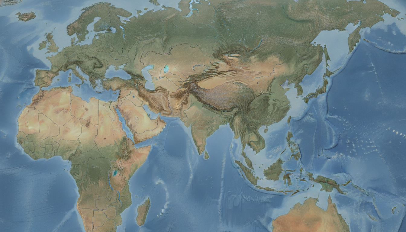
In short, what you'll discover in this article: Explore the essential types and features of a detailed Asia map to plan your trip effectively. Learn about political, physical, and thematic maps, key elements to include, data sources, and practical uses.
Get tips on map projections, customization tools, and where to download high-quality maps.
1. Introduction — Why a Detailed Asia Map Is Useful
Planning a trip across several countries in Asia can be exciting but also overwhelming without the right tools. A detailed Asia map provides a clear and comprehensive view of the continent’s geography, helping you visualize borders, cities, transportation routes, and natural features.
This clarity is crucial for creating efficient travel routes and discovering interesting places you might otherwise miss.
Having access to a detailed map reduces confusion and speeds up your planning process. It also supports understanding how countries connect and what lies nearby each destination.
Whether for personal travel or academic purposes, a detailed map of Asia is an invaluable resource.
2. Types of Detailed Maps for Asia
2.1 A Detailed Political Map of Asia
A political map highlights country borders, capital cities, and administrative subdivisions such as provinces or states. It often includes disputed zones to reflect geopolitical complexities.
This type of map is essential for travelers who want to understand the political landscape and plan visits accordingly.
2.2 The Physical Map of Asia with Details
Physical or topographic maps showcase natural features like mountains, plains, rivers, and elevation changes. They use shading or contour lines to represent terrain relief and help travelers identify geographic obstacles or scenic areas worth visiting.
2.3 Thematic Maps (Population, Climate, Languages, Economy)
Thematic maps focus on specific data layers such as population density, climate zones, linguistic distribution, or economic activity. These maps provide insights beyond geography that can influence travel decisions or academic research.
2.4 Maritime Maps and Exclusive Economic Zones (EEZ)
Maritime maps detail coastlines, islands, seas, ports, and Exclusive Economic Zones (EEZ). For travelers interested in cruises or coastal regions, these maps offer valuable information about marine boundaries and navigation routes.
3. Essential Elements to Include in a Detailed Asia Map
3.1 Borders and Statuses (Including Disputed Areas)
Clear delineation of international borders is fundamental. Including disputed territories helps avoid confusion during travel planning in politically sensitive regions.
3.2 Major Cities and Urban Hierarchy
A detailed map should mark capital cities prominently along with major urban centers ranked by size or importance. This helps prioritize destinations and understand regional hubs.
3.3 Transportation Networks (Roads, Railways, Ports, Airports)
Displaying highways, rail lines, major ports, and airports allows travelers to plan efficient routes using various transport modes.
3.4 Hydrography (Rivers, Lakes, Coastal Areas, Archipelagos)
Rivers like the Yangtze or Ganges are vital geographic features influencing settlement patterns and travel routes. Lakes and coastal archipelagos add important context for navigation or sightseeing.
3.5 Relief and Elevation Profiles (Contours, Shading, DEM)
Elevation data represented through contour lines or shaded relief enhances understanding of mountainous regions such as the Himalayas.
3.6 Legends, Scales, Projection Types, Coordinates
A comprehensive legend explains symbols used; scales indicate distances; projection types affect how the curved surface of Earth is represented; coordinates allow precise location referencing.
4. Formats and Data Sources
4.1 Free and Reliable Sources
OpenStreetMap offers community-driven detailed geographic data worldwide. Natural Earth provides public domain vector and raster map data suitable for various scales.
GADM specializes in administrative boundaries while SRTM delivers elevation data from satellite missions.
4.2 Available Formats
Maps come in multiple formats including GeoJSON for web mapping, Shapefile for GIS software compatibility, KML for Google Earth integration, SVG for scalable graphics editing, and raster formats like PNG or TIFF for static images.
4.3 Commercial Data and Satellite Options
Paid options offer higher resolution satellite imagery or specialized datasets useful for professional applications but may require licensing fees.
5. Practical Uses and Applications
5.1 Travel Planning and Itinerary Design
A detailed Asia map helps travelers visualize routes between countries like China, India, Japan, or Southeast Asian nations efficiently.
5.2 Academic Research and Socio-Economic Analysis
Researchers use thematic maps to study population trends or climate impacts across diverse Asian regions.
5.3 Logistics, Transport Management & Disaster Response
Detailed maps assist logistics companies in route optimization while emergency responders rely on them for disaster preparedness.
6. How to Choose the Right Projection and Scale
6.1 Recommended Projections for Asia
Albers Equal Area Conic projection balances area distortion across Asia’s vast east-west extent well for thematic mapping purposes. Mercator projection is common but distorts size near poles; use it cautiously especially for large-scale regional views.
6.2 Impact of Scale on Detail Level
Larger scale maps (e.g., 1:1 million) show more detail suitable for city planning while smaller scale maps (e.g., 1:10 million) provide broad overviews ideal for continental perspectives.
7. Customization and Tools
7.1 Free Tools (QGIS, GDAL) and Editing Tutorials
QGIS is a powerful open-source GIS software enabling map customization with layers from various sources including OpenStreetMap data. GDAL supports format conversions between raster/vector files.
7.2 Web Integration (Leaflet, Mapbox, Vector Tiles)
Interactive web maps can be created using Leaflet or Mapbox platforms that support vector tiles allowing smooth zooming without losing detail.
7.3 Style Tips (Palette Choice, Readability & Accessibility)
Use contrasting colors for borders versus backgrounds; limit color palettes to avoid clutter; ensure fonts are legible at different zoom levels; consider colorblind-friendly schemes.
8. Downloading Maps and Licensing
8.1 How to Obtain Downloadable Files & Usage Terms
Many websites offer free downloadable maps such as MapChart’s detailed Asia map where you can customize colors before downloading without cost.
8.2 Attribution & Open-Source Data Compatibility
Respect licenses by providing attribution when required; OpenStreetMap data typically requires crediting contributors under ODbL license terms.
9. SEO Tips & Accompanying Content for Ranking Well
9.1 Keywords to Include Naturally
Integrate keywords like detailed asia map, Asia map high resolution, Asia map download, vector Asia map smoothly within content paragraphs without keyword stuffing.
9.2 Offering Downloadable Examples & Optimized Images with Metadata
Provide readers with sample downloadable maps in various formats alongside optimized images tagged with descriptive alt texts improves user engagement and SEO performance.
##10 Conclusion And Additional Resources
A detailed Asia map is indispensable for travelers aiming to explore multiple countries with confidence as well as researchers analyzing the continent’s diverse geography. By understanding different map types—political, physical, thematic—and key elements like borders, cities, transport networks, you can select the best resources tailored to your needs.
For interactive detailed maps or printable versions suitable for trip planning visit this full map of Asia. To dive deeper into specific regions consider exploring the China and East Asia map or map of Southeast Asia.
When preparing your trip connectivity options across Asia’s countries matter too—consider checking out eSIM data plans available via MyBestSim’s comparison platform to stay online seamlessly during your travels without roaming fees.
Bullet List: Key Features To Look For In A Detailed Asia Map
- Clear country borders including disputed zones
- Major cities with capital prominence
- Transportation routes: roads, railways, airports
- Natural features: rivers, mountains, lakes
- Elevation profiles with contour shading
- Legends explaining symbols & scales
- Accurate coordinate grids
Numbered List: Steps To Customize Your Own Detailed Asia Map
- Choose your base data source (e.g., OpenStreetMap)
- Select relevant layers: political boundaries + physical features
- Use GIS software like QGIS to style colors & labels
- Export in preferred format (GeoJSON/SVG/PNG)
- Add metadata & optimize image size before sharing
For travelers seeking reliable connectivity during their Asian adventures—providers like Yesim offer competitive eSIM plans with promo codes such as MYBESTSIM20 that can save you up to 20%. Other notable providers include LinkeSIM with a -5% unlimited promo code MYBESTSIM or Airalo offering -10% unlimited plans under the same code.
References: For creating custom editable maps visit MapChart’s detailed Asia map, which allows coloring subdivisions interactively before downloading free files tailored to your project needs.
This comprehensive guide equips you with everything needed to find or create a detailed Asia map that suits your travel planning perfectly while ensuring you stay connected throughout your journey with smart eSIM choices from trusted providers compared on MyBestSim.
FAQ
What types of detailed maps are available for Asia?
Detailed Asia maps include political maps showing borders and capitals, physical maps highlighting terrain and elevation, thematic maps focusing on data like population or climate, and maritime maps detailing coastlines and Exclusive Economic Zones.
Which key elements should a detailed Asia map include?
A detailed Asia map should feature clear country borders including disputed areas, major cities with capital prominence, transportation networks like roads and airports, natural features such as rivers and mountains, elevation profiles, and a legend explaining symbols and scales.
Where can I find free reliable data sources for Asia maps?
Free reliable sources for Asia map data include OpenStreetMap for community-driven geographic details, Natural Earth for public domain vector and raster data, GADM for administrative boundaries, and SRTM for satellite-derived elevation information.
How do map projections affect the accuracy of Asia maps?
Map projections impact how the Earth's curved surface is represented; for Asia, the Albers Equal Area Conic projection balances area distortion well across the continent, while Mercator projection can distort size near poles and is better suited for smaller regional views.
What tools can I use to customize my own detailed Asia map?
You can customize detailed Asia maps using free GIS software like QGIS for layering and styling, GDAL for format conversions, and web platforms like Leaflet or Mapbox to create interactive maps with smooth zooming and vector tiles.

Liam Chen
Liam is a travel and technology writer based in Southeast Asia who has tested eSIMs across the region. At Singapore eSIM he compares travel data plans on Singtel, StarHub and M1 and helps visitors stay online affordably from Changi to Sentosa.